As a continuation of the previous post, Maps of the World by Number of Children and Number of Spouses of Leaders, I have made a set of maps for the Canadian provinces and territories. The process I followed here was similar to that of the previous post. One major difference between the two sets of maps is that data on Canadian lieutenant governors and premiers is a lot easier to find. For the sake of simplicity I have included the territorial commissioners (for Yukon, Northwest Territories, and Nunavut) under the count for “lieutenant governors” – they are not, though, representatives of the monarch (Queen Elizabeth II).
For the map boundaries I used the Canadian province and territory boundaries shapefile from ArcGIS.
The raw data collected is displayed in the following table:
| Province | Lieutenant Governor / Commissioner | Spouses | Children | Premier | Spouses | Children |
|---|---|---|---|---|---|---|
| Alberta | Lois Mitchell | 1 | 4 | Rachel Notley | 1 | 2 |
| British Columbia | Judith Guichon | 2 | 4 | Christy Clark | 1 | 1 |
| Manitoba | Janice Filmon | 1 | 4 | Brian Pallister | 1 | 2 |
| New Brunswick | Jocelyne Roy-Vienneau | 1 | 2 | Brian Gallant | 0 | 0 |
| Newfoundland and Labrador | Frank Fagan | 1 | 3 | Dwight Ball | 1 | 1 |
| Northwest Territories | George Tuccaro | 1 | 2 | Bob McLeod | 1 | 1 |
| Nova Scotia | John James Grant | 1 | 4 | Stephen McNeil | 1 | 2 |
| Nunavut | Nellie Kusugak | 1 | 4 | Peter Taptuna | 1 | 5 |
| Ontario | Elizabeth Dowdeswell | 1 | 0 | Kathleen Wynne | 2 | 3 |
| Prince Edward Island | Frank Lewis | 1 | 5 | Wade MacLauchlan | 1 | 0 |
| Quebec | J. Michel Doyon | 1 | 2 | Philippe Couillard | 1 | 5 |
| Saskatchewan | Vaughn Solomon Schofield | 1 | 2 | Brad Wall | 1 | 3 |
| Yukon Territory | Doug Phillips | 1 | 5 | Darrell Pasloski | 1 | 4 |
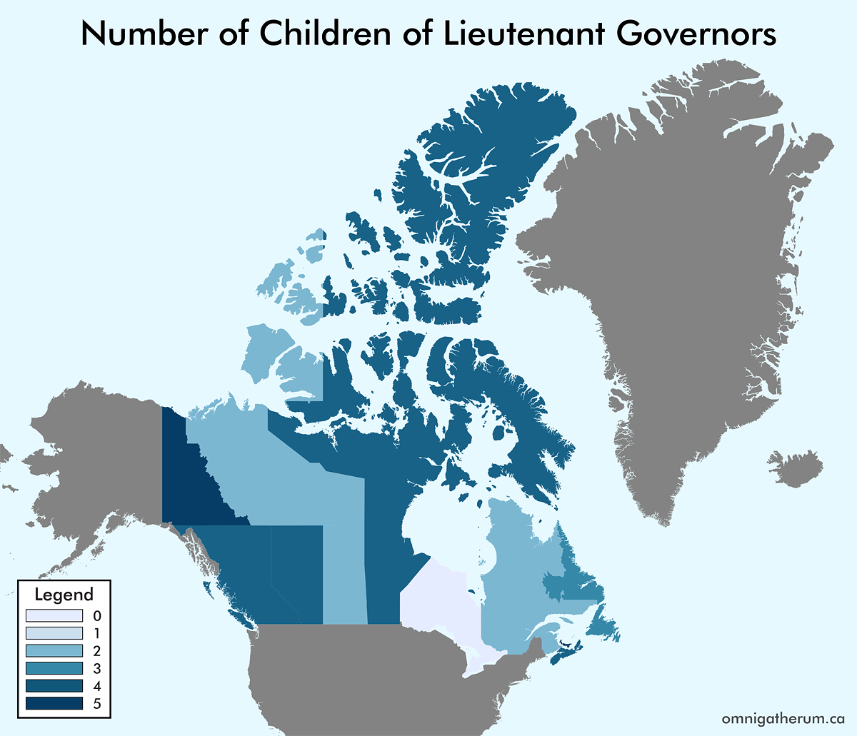
Number of Children of Lieutenant Governors
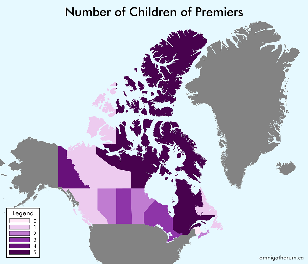
Number of Children of Premiers
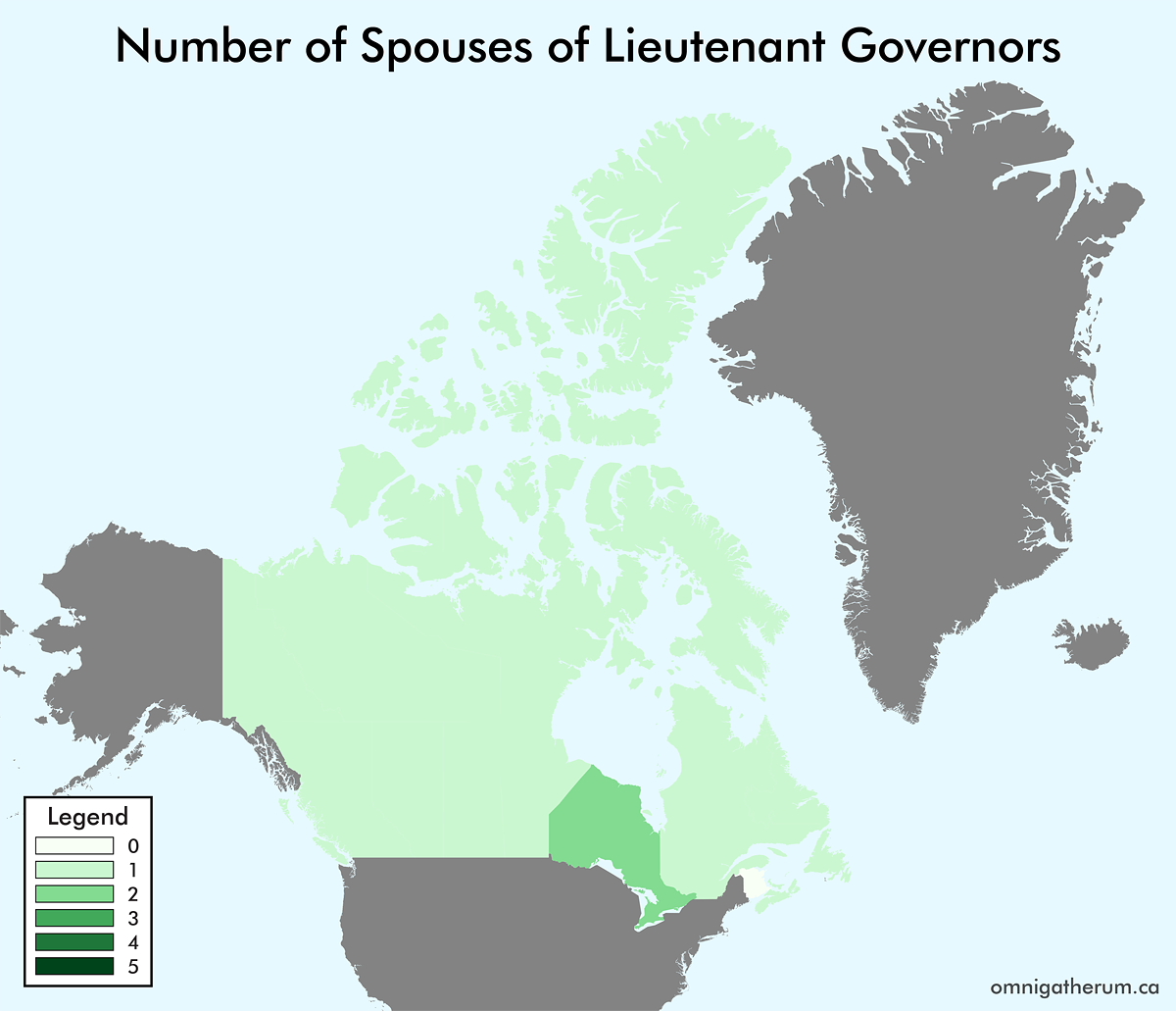
Number of Spouses of Lieutenant Governors
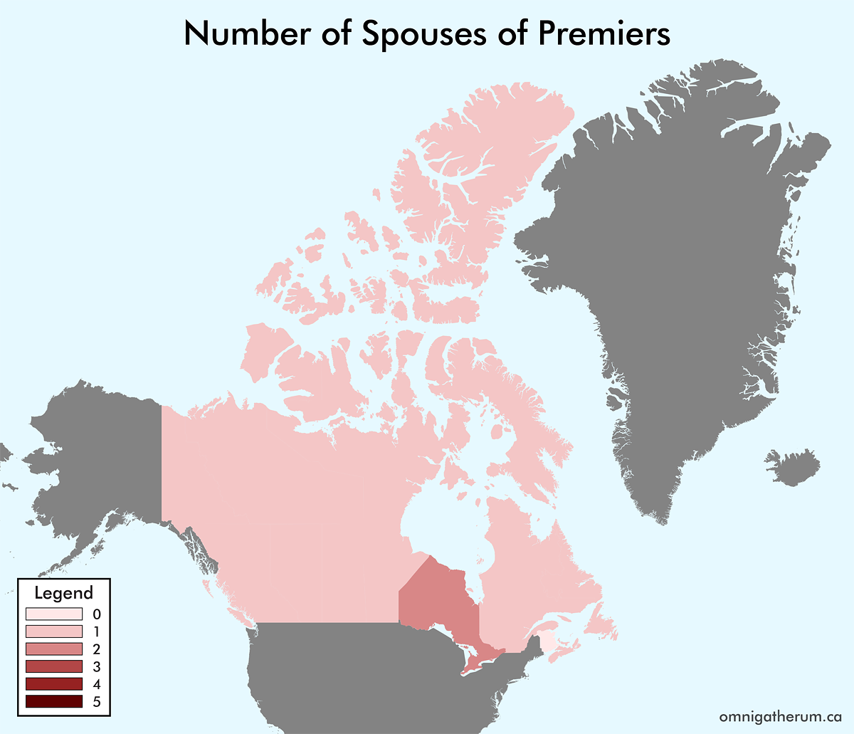
Number of Spouses of Premiers